Drones in Mining: How the Industry Uses UAVs and What It Means for Your Students
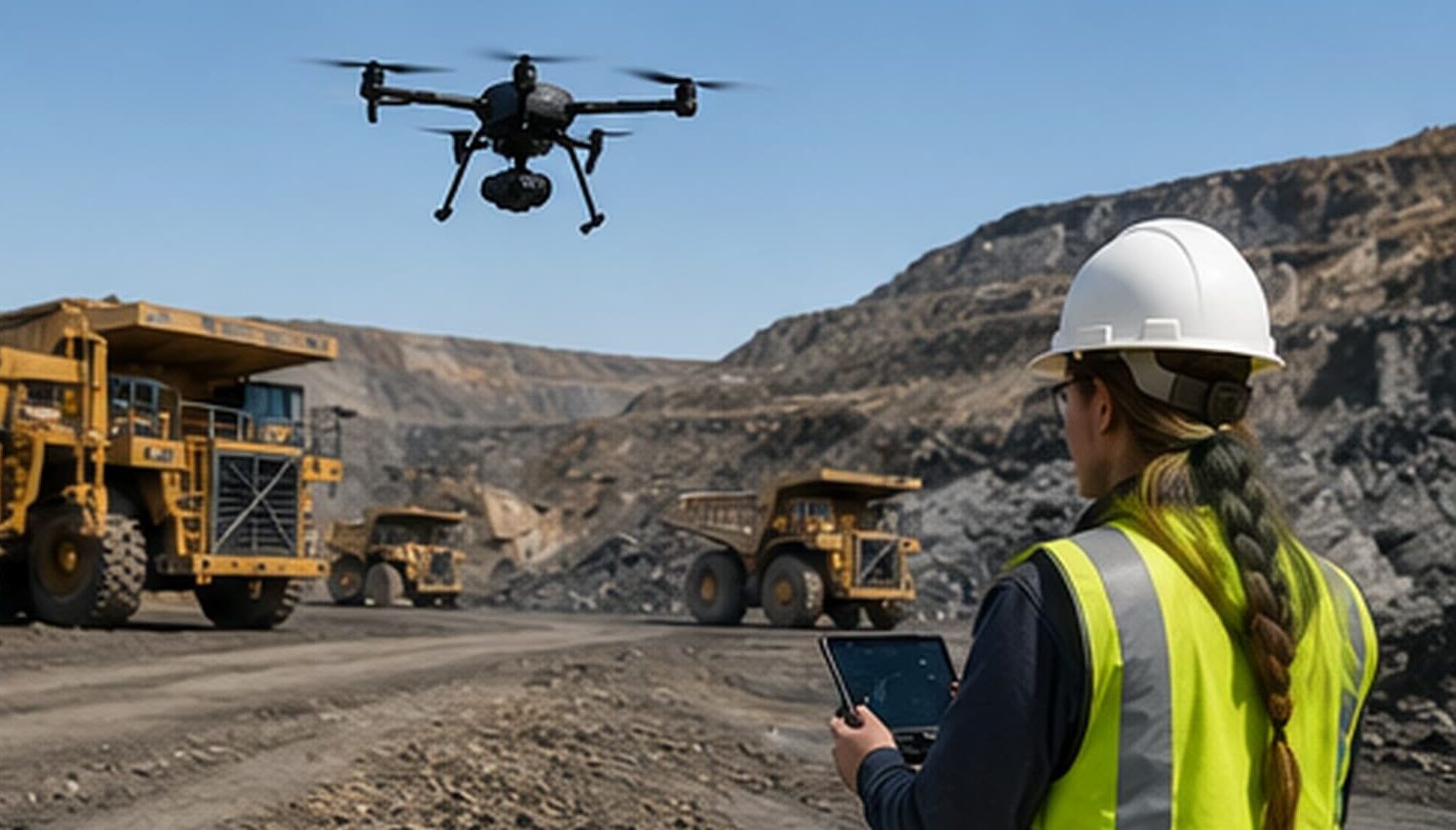
Mining companies use drones for surveying, stockpile measurement, equipment inspection, and environmental monitoring. Every one of those functions requires a trained operator, and the supply is not keeping up with demand. According to Verified Market Research, the global drones in mining market is projected to grow from $4.36 billion in 2024 to $10.16 billion by 2032.
For Career and Technical Education (CTE) coordinators advising students on technical careers, that growth creates a direct opening. Students pursuing geology, surveying, engineering, or environmental science are heading into fields where drone operation is already part of the job. The ones who graduate with flight hours, a portfolio, and an FAA certification walk into interviews with something most applicants their age can’t show.
This article covers how drones are used across mining operations, what roles exist for operators, what employers screen for beyond the certificate, and how students can start building that foundation now.
Key Takeaways
- Mining companies use drones daily for surveying, stockpile measurement, equipment inspection, and environmental monitoring, and each function requires trained operators.
- The Federal Aviation Administration (FAA) Part 107 is the legal baseline for paid drone work. Mining employers screen for manual flight proficiency, data collection ability, and field safety knowledge beyond the certificate.
- Students pursuing geology, surveying, engineering, and environmental science all work in industries where drone operations have become a standard part of the job.
- Rocket Drones prepares students from grades 3 through 12 with logged flight hours, a video portfolio, and FAA Part 107 training so they enter the workforce with credentials employers can verify.
How Drones in Mining Are Used Across Operations
Each section below represents a real job category in the mining sector. When your students understand how drones in mining are used across surveying, inspection, stockpile management, and environmental monitoring, they understand what mining employers are hiring for.
Surveying and Mapping
Mining operations depend on accurate terrain data for planning excavations, tracking progress, and meeting regulatory requirements. Before drones, producing a topographic survey (a detailed map showing the shape and elevation of the land) of a large mine site required ground crews working for days or weeks.
Drones equipped with high-resolution cameras and LiDAR (Light Detection and Ranging) sensors, which use laser pulses to measure distances and build detailed terrain maps, now cover the same ground in hours.
The resulting 3D models are used for everything from pit design to reclamation planning, the process of restoring mined land to a usable condition once extraction is complete.
Stockpile Measurement
Mining companies need to know exactly how much ore, overburden (the rock and soil removed to reach mineral deposits below), or processed material is sitting on site at any given time.
Manual estimation is slow and prone to error. Drones fly over stockpiles and capture hundreds of overlapping images from multiple angles, which software processes into accurate volume calculations.
A measurement that once took a survey crew a full day now takes less than an hour, and the data feeds directly into inventory and logistics systems.
Facility and Equipment Inspection
Pit walls, haul roads, tailings dams, processing facilities, and underground structures all require regular inspection. Many of those environments are too dangerous or difficult to access safely on foot.
Drones equipped with thermal cameras and high-resolution sensors inspect elevated structures, confined spaces, and unstable terrain without putting workers at risk. They detect equipment failures, structural issues, and temperature anomalies that would be difficult to identify through manual inspection.
Environmental Monitoring
Mining operations in the United States are subject to strict environmental regulations covering erosion, water runoff, dust levels, and land reclamation. Drones track these conditions across large sites systematically, producing the documented records that regulators require.
In mining communities across Appalachia, the Mountain West, and the Southwest, where environmental compliance is closely tied to a company’s license to operate, this monitoring function has become a core part of daily operations.
How Drone Skills Give Your Students a Hiring Edge in Mining Careers
Most students planning careers in geology, engineering, or environmental science don’t realize drone operation is already part of those jobs. A geology graduate applying for a mine planning role will be expected to work with drone-collected terrain data. An environmental science major entering a compliance position will review monitoring reports that drones produced. The technology is not a separate career track. It’s woven into the roles your students are already preparing for.
That’s where the hiring gap shows up. Mining employers are not just looking for dedicated drone operators. They need geologists, surveyors, and environmental specialists who also understand how drones collect and process field data. A student who graduates with that combined skill set solves two problems for a hiring manager at once.
In mining regions like Appalachia, the Mountain West, and the Southwest, this advantage is even more direct. Local employers run the drone programs your students will encounter on the job. A graduate who already knows how to fly, collect survey data, and interpret the output does not need months of on-the-job training to become useful. That’s a measurable advantage over every other applicant in the same candidate pool.
What Qualifications Do Mining Drone Operators Need?
The FAA Part 107 commercial drone license is the legal requirement for any paid drone work in the United States. Passing the exam demonstrates a candidate understands airspace classifications, flight regulations, and safety procedures.
Mining employers also need someone who can pilot a UAV (Unmanned Aerial Vehicle) manually underground where GPS (Global Positioning System) fails, read thermal inspection data, and produce survey reports engineers can act on.
Here is what a qualified mining drone operator is expected to bring to the role:
- Manual flight proficiency: Flying without GPS or automated sensors, which is essential in underground environments where satellite signals don’t reach.
- Surveying and mapping: Operating camera and sensor payloads that capture data software can stitch into 3D terrain models and volumetric measurements.
- Mission planning: Mapping routes, assessing site conditions, and preparing for variables specific to mine environments before the flight begins.
- Safety awareness: Understanding the hazard environment of mine sites, including confined spaces, unstable terrain, and atmospheric risks.
- GIS fundamentals: Processing and interpreting the spatial data drones collect using Geographic Information System (GIS) tools that map and analyze location-based data.
- Communication and reporting: Translating drone data into clear reports that engineers, site managers, and environmental teams can act on.
Students with logged flight hours, a video portfolio, and hands-on drones in mining experience can speak to every one of those requirements in an interview.
How Rocket Drones Helps Students Develop Drone Skills for Mining
Rocket Drones builds drone education programs for grades 3 through 12. We offer curriculum, hands-on flight training, certification preparation, and a career pathway framework designed around the skills industries like mining are hiring for.
Students who complete the program leave with a certificate, logged flight hours, and a portfolio of documented flights.
FAA Part 107 Certification Training
We prepare students aged 16 and older to sit and pass the FAA Part 107 exam, the commercial drone license required for any paid drone work in the United States. The exam covers airspace rules, weather conditions, flight planning, and safety.
Mining employers ask for it before they consider a candidate for any field role, which makes it the first credential students pursuing drone careers in natural resources need to earn.
Hands-On Flight Training and Portfolio Building
We train students to fly manually without GPS or sensor assistance, which is what mining employers need for operators working in underground environments where automated navigation fails. Students log flight hours throughout the program and build a drone certification portfolio documenting their work alongside their certificate.
Surveying and Mapping in the Classroom
Surveying and mapping are the mining applications that translate most naturally into classroom-based drone education. Students learn how to capture overlapping aerial images, how photogrammetry software processes that data, and how operators use the results to support real-world planning decisions.
These are the same workflows geologists, surveyors, and environmental scientists use on mine sites daily. A student who understands that workflow before they graduate is already thinking like the professional they’re training to become.
Curriculum That Fits Existing CTE Pathways
Our drone curriculum is built to complement existing energy and manufacturing pathways. A student already pursuing welding, environmental science, or industrial systems has the technical foundation that makes drone skills a natural fit.
Instructor training is built into the program, which means any CTE educator can integrate drone certification into their existing classroom without starting from scratch.
Drone Certification Gives Your Students a Hiring Edge in Mining Careers
As mining companies expand their drone programs, demand for trained operators will keep growing. Students who graduate with practical drone skills, such as surveying, inspection, and manual flight proficiency, walk into interviews with something most applicants their age can’t show.
Contact us to learn how Rocket Drones helps you prepare students with the drone skills mining companies are hiring for.
Frequently Asked Questions
What types of drones are used in mining?
Do mining companies hire drone operators directly?
Can students enter mining drone careers without prior mining experience?
What do mining companies use drones for?
What skills do mining employers look for beyond the certificate?
Nationals 2026
is around the corner.
Aerial Perspectives Podcast

Discover the exciting world of drones with Aerial Perspectives! Each episode takes you behind the scenes with drone pilots from diverse industries–cinematography, construction, inspection, agriculture, and more.


